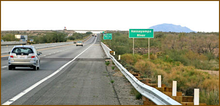
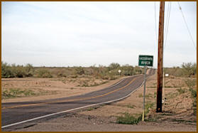
Hassayampa River
The word Hassayampa is an old Indian
word that means “the river that flows
upside down.” All tributaries on the
west side of the Bradshaws flow into the
Hassayampa. It is another one of
Arizona’s longer rivers spanning just
over 100 miles. Through the years, 37, I
have been able to hike and explore most
of this river system and several side
tributaries, from the head waters to a
few miles below the Hassayampa Preserve.
The long stretches between the town of
Wickenburg to Baseline Road, I have
seldom visited and prefer the higher
river portions.
The Hassayampa originates as a small
spring on the north side of Mount Davis.
When the river reaches Potato Patch many
strong springs push its water above
ground and create a year round stream.
The stream continues to flow most of the
year until reaching Buzzard Roost Creek
near the FS Road 72. From this point to
Wickenburg, it holds to its name and
pops up flowing above ground and later
disappears underground. See the map
below for areas that have continuous
flows.
Old folklore predicts anyone who drinks
from the river can never again tell the
truth. In the late 1800’s, the term
“Hassayampers" began to be used and
defined a person who came to the river
in search for gold.
Below I have divided up sections of the
river so you can plan visits to the
river portions that draw you. The images
begin at the headwaters and follow the
river downstream in order.
|
|
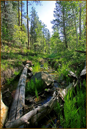
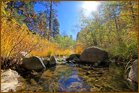
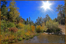
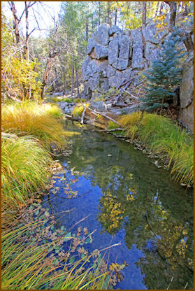
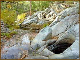
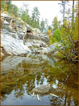
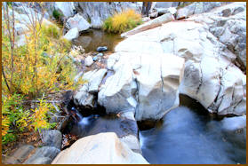
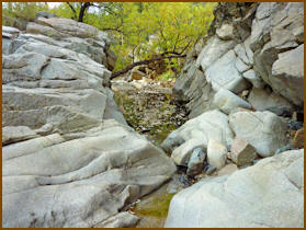
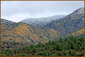
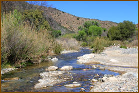
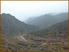
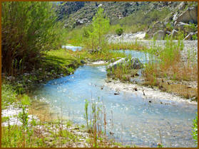
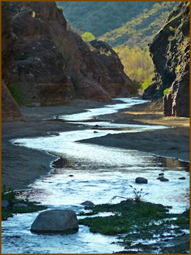
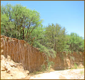
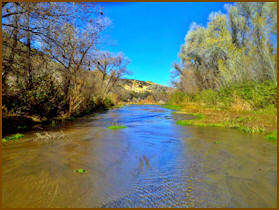
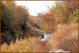
Mount Davis to Buzzard Roost Creek
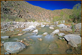
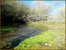
Here the river flows through lush plant
and pine forests attracting numerous
wildlife. As it gets closer to Buzzard
Roost Creek, it becomes harsh and rocky.
Fish thrive where the water flows and
swimming holes are heavily visited
during hot summers. Some areas are on
private property, so respect and ask
permission.
|
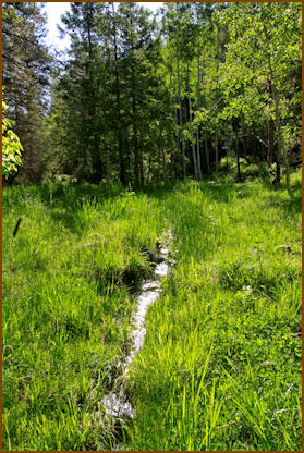
Headwater Spring fed stream |
Near Potato Patch |
|
|
|
|
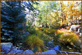
Near Hassayampa Lake |
Between Maxton and Wolf Creek |
| |
|
 |
Above Wolf Creek |
|
|
|
|
Between Maxton and Wolf Creek
|
Between Maxton and Wolf Creek
|
| |
|
 |
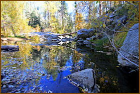
Near Ponderosa Park |
| |
|
Above Copper Creek |
Hassayampa Hole |
| |
|
Hassayampa Hole |
Below Copper Creek |
| |
|
 |
Near Orofino Wash |
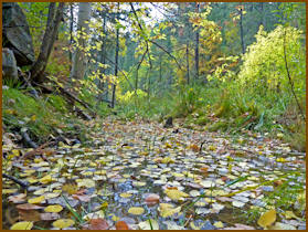
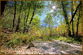
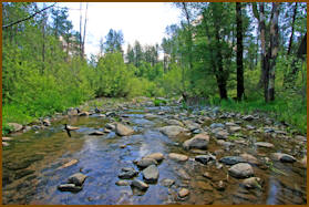
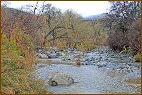
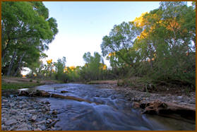
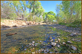
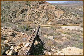
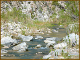
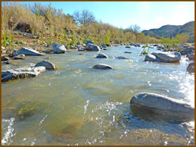
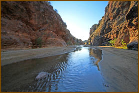
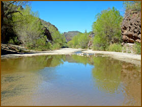
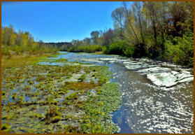
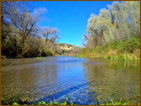
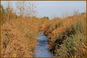
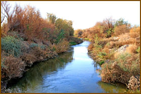
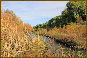
Buzzard Roost Creek to Minnehaha
Creek
The river widens and flows above ground
year around. Lush riparian areas meander
through large ranches which use these
waters for cattle and crop growing. The
historic bridge, listed in the National
Registry of Historical places, is above
a beautiful access point. Indian ruins
and rock art can be found nearby for
adventurous. |
Buzzard Roost Creek area |
Near Middle Water Creek |
| |
|
Near Collins Spring |
Below Collins Spring |
| |
|
Below Historic Bridge |
Near Walnut Grove |
| |
|
Below Walnut Grove |
Milk Creek area |
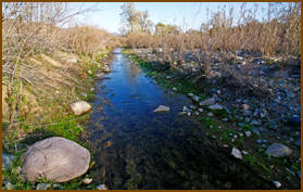
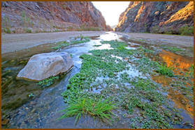
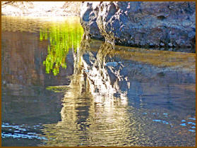
Minnehaha Creek to Hassayampa River
Canyon Wilderness
Here again the river plunges into a
remote beautiful canyon flowing year
around. Willows and cottonwoods flourish
but few venture into this area. Many
years ago a wooden dam, creating a large
lake, broke staging Arizona’s worst
disaster. On February 22, 1890, the dam
burst on a dark rainy night. Mining
camps and towns, downstream were
completely decimated by the massive wall
of water. It’s believed over 100 people
perished. Wickenburg, too, was flooded.
Since the dam site is on private
property, contact us for a tour. |
Below Minnehaha Creek |
Old historic dam site |
| |
|
Above wilderness boundary |
Near Wilderness boundary |
| |
|
Near Wilderness boundary |
|
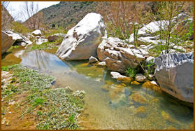
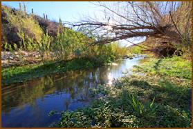
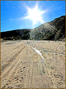
Northern Boundary to Southern
Boundary of Hassayampa River Canyon
Wilderness
The United States Congress designated
the Hassayampa River Canyon Wilderness (map)
in 1990 to include the 12,300 acres
under BLM (Bureau of Land Management)
management. To access this wilderness,
most hikers travel from Wickenburg on
the Constellation Road toward the
Williams Ranch, a total of about 16
miles. You need to ask for permission to
cross ranchland until you reach the
nearby Wilderness boundary that is about
a 1/4 mile from the parking lot. Even
though this area is wilderness, you will
find it over grazed and plenty of cow
pies to avoid. Consider another route
seldom taken. Take the Wagner Road above
the wilderness area and drop into the
canyon via Cherry Creek. Here a four
wheel drive road accesses the river. You
will find it less used by cattle and
very secluded. The wilderness boundary
is about a 2 ½ mile hike downstream. |
North end of wilderness |
Middle wilderness |
| |
|
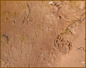
Tracks |
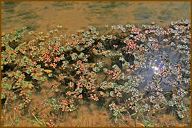
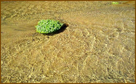
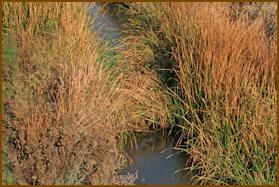
Aquatic vegetation in wilderness pools |
| |
|
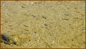
Minnows |
 |
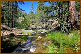
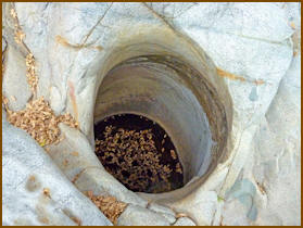
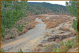
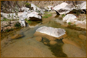
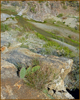
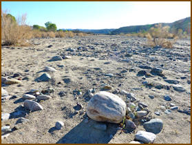
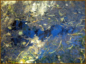
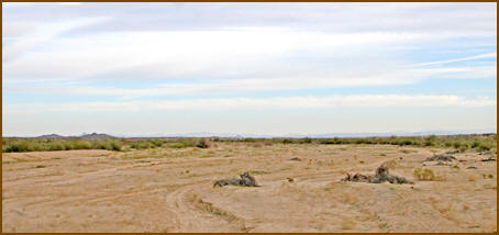
Southern Boundary Hassayampa River
Canyon Wilderness to Box Canyon
The river intermittently flows
underground. There are several beautiful
riparian sections here. Most of this
section can be traveled by ATV and has
become a popular destination accessed
through Rincon Road. Old abandoned
mining camps dot the landscape. Box is a
water carved quarter mile slot canyon. A
gauging station is located on the
Southern end. About a mile below Box
Canyon the river flows underground. |
Below wilderness boundary |
Below wilderness boundary |
| |
|
Near King Salomon Gulch |
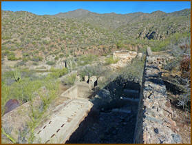
Old mining camps, mill sites and mines |
| |
|
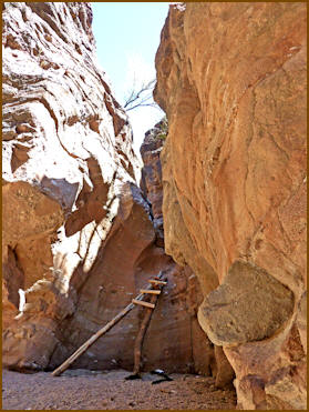
Box Canyon |
Box Canyon |
| |
|
Box Canyon |
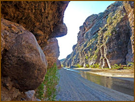
Box Canyon |
| |
|
Near Box Canyon |
Below Box Canyon |
| |
|
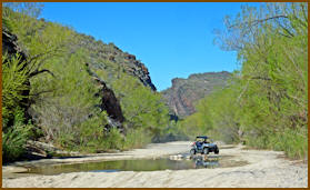
Popular ATV area below Box Canyon |
|
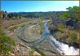
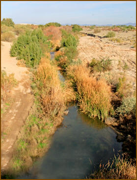
Box Canyon to Hassayampa River
Preserve
A mile below Box Canyon the river opens
into sand, the water plunges deep
underground and reappears shortly below
Highway 93 Bridge, Wickenburg. Again it
reappears creating permanent flow
through a riparian forest. Visit the
Hassayampa River Preserve where displays
and trails detail this unique river
system. The preserve offers a birder's
paradise and has been managed by The
Nature Conservancy since 1986. Over 280
species have been spotted within the
preserve. The menu offered, ranges from
ranger led nature walks to baking
mesquite bread in the preserve’s earth
ovens. Visit their website
here. |
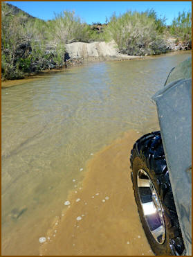
River crossings |
Side canyon below Box Canyon |
| |
|
Below Hassayampa River Preserve |
Above Rincon Road |
| |
|
Picsay Hassayampa River Preserve |
Picsay Near Hassayampa River Preserve |
| |
Above Wickenburg |
Hassayampa River Preserve to Baseline
Road
A couple of miles below the Preserve,
the river disappears underground, flows
underground below I10, and emerges just
below Baseline Road, only flowing due to
flash floods. Below the Preserve is a
roadside rest area that presents another
hiking opportunity to flowing waters. |
Picsay Below Hassayampa River Preserve |
Picsay Below Hassayampa River Preserve |
| |
|
Near Red Cliff |
Near Dos Palmis Well |
| |
|
Interstate 10 |
| |
|
Above Interstate 10 |
| |
|
Below Interstate 10 |
Above Baseline Road |
| |
|
Baseline Road |
 |
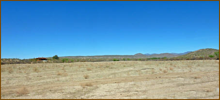
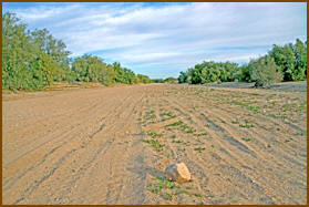
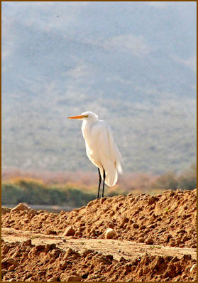
Baseline Road to Gila River
Years of flooding have created fertile
soil where alfalfa and cotton thrive,
producing farms fields along the river
banks. Water spillage originating from
irrigation overflow create a year round
flowing stream again. In places,
sunfish, carp, and bass thrive in
hard-to-reach pools. The thick riparian
forest holds tamarisk, willow and
cattails. In the winter, larger water
reliant birds visit this section that is
seldom visited, Excellent bird viewing
and photographing opportunities exist
here, just outside Phoenix. Soon the
Hassayampa ends flowing into the Gila
River completing its 100 mile journey. |
Great birding area |
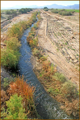
Below Baseline Road |
| |
|
 |
 |
| |
|
Below Baseline Road |
Near Johnson Road |
| |
|
Near Narromore Road |
Near Gila River |
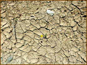
Map
I have indicted areas that have
consistently held water even during the
10 drought. During wet cycles and summer
flash flooding, other portions may flow.
Never hike river bottoms during summer
monsoon season.
Click on the
map to view “normal” water flow
areas. |
| |
|