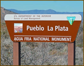
Agua Fria National Monument
 The
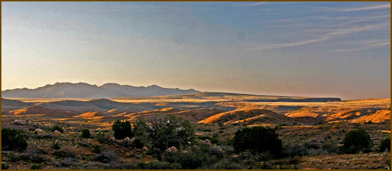
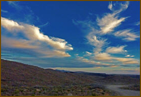
Agua Fria National Monument encompasses
70,900-acres (111 square miles). It is
located on the east side of the
Bradshaws about 40 miles north of
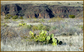
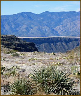
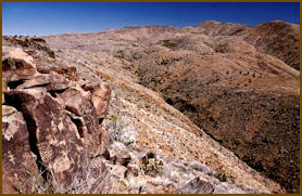
Phoenix. The Agua Fria River cuts
through this plateau exposing a deep
mini Grand Canyon of Precambrian rock
along the canyon walls. Monument
elevations range from 2,150 feet at the
bottom of the Agua Fria Canyon to about
4,600 feet in the northern hills. The
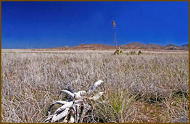
area is located on high mesa,
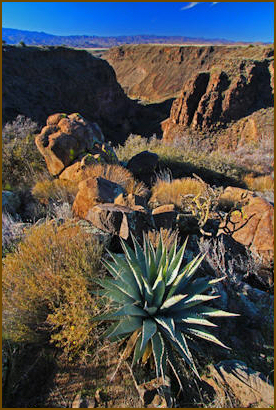
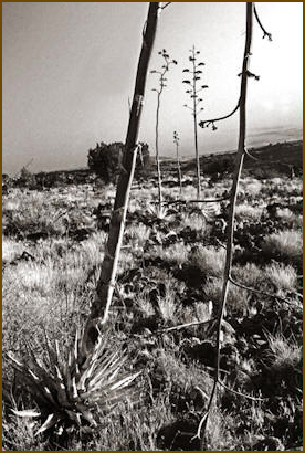
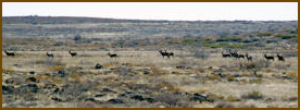
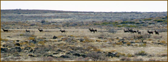
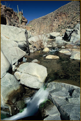
semi-desert grassland. The Agua Fria
River offers ribbons of valuable
riparian forest, attracting a variety of
wildlife. Coyotes, bobcats, antelope,
mule deer, white tail deer, javelina, a
variety of small mammals and songbirds
utilize this area. Eagles and other
raptors are also present. Native fish
such as the longfin dace, the Gila
mountain suckers, the Gila chub, and the
speckled dace, live in the river and
several tributary streams. The
Agua Fria National Monument encompasses
70,900-acres (111 square miles). It is
located on the east side of the
Bradshaws about 40 miles north of
Phoenix. The Agua Fria River cuts
through this plateau exposing a deep
mini Grand Canyon of Precambrian rock
along the canyon walls. Monument
elevations range from 2,150 feet at the
bottom of the Agua Fria Canyon to about
4,600 feet in the northern hills. The
area is located on high mesa,
semi-desert grassland. The Agua Fria
River offers ribbons of valuable
riparian forest, attracting a variety of
wildlife. Coyotes, bobcats, antelope,
mule deer, white tail deer, javelina, a
variety of small mammals and songbirds
utilize this area. Eagles and other
raptors are also present. Native fish
such as the longfin dace, the Gila
mountain suckers, the Gila chub, and the
speckled dace, live in the river and
several tributary streams.
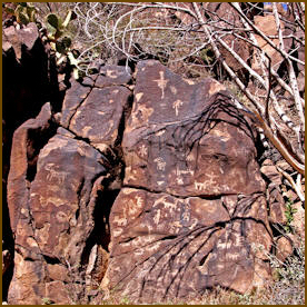
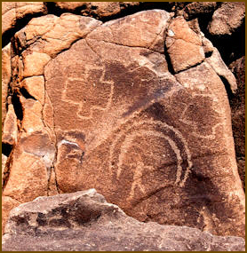
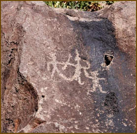
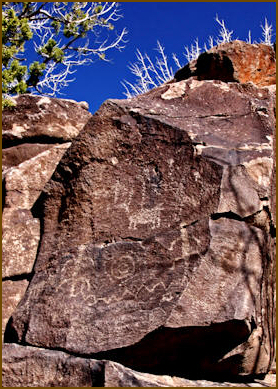
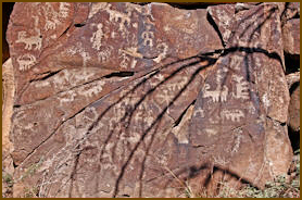
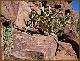
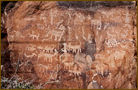
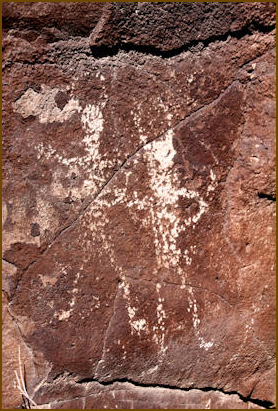
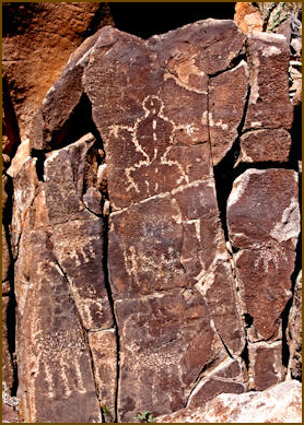
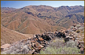
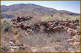
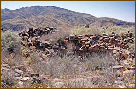
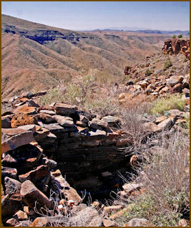
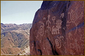
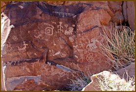
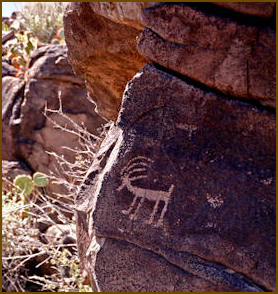
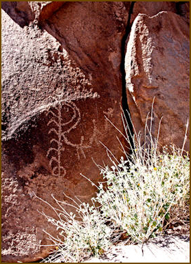
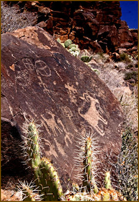
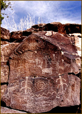
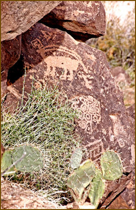
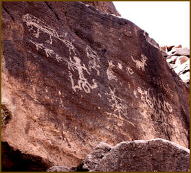
The monument offers some of the most
amazing well-kept prehistoric sites in
the American Southwest. More than 450
archaeological sites are spread out
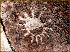
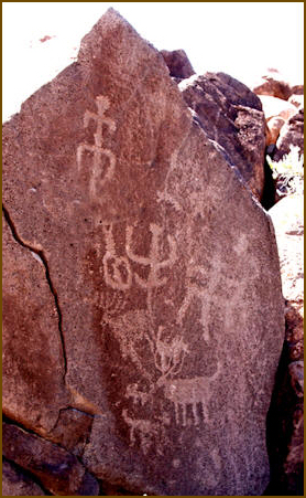
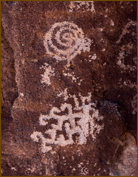
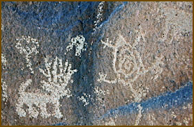
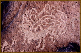
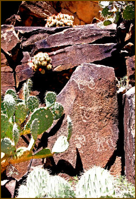
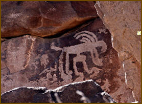
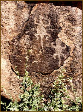
around the Monument. Petroglyphs (rock
art) and matate's are also present.
Numerous pueblo ruins, which were built
between 1250 and 1450 A.D, supported a
population of several thousand Native
Americans, known as the Perry Mesa
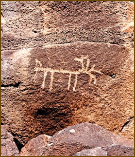
Tradition. Hundreds of petroglyphs
depict wildlife, geometric figures,
humans and other abstract symbols.
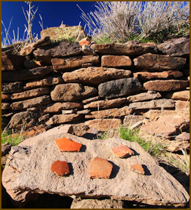
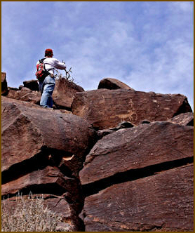
When you find an archaeological site
please observe, enjoy and photograph
them while leaving all artifacts as you
found them for others to discover and
appreciate. Do not touch rock art
symbols or take pottery shards. Defacing
archaeological sites is vandalism and is
punishable by law. Remember, hidden
cameras watch over many of these
sensitive sites.
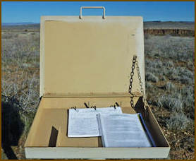
The best access to the monument is from
the Bloody Basin Road exit. Turn east
and here you will find information
kiosks with maps and information.
Click here to see our Agua Fria
River Page
|